The straight line that takes us from the Colón Metro Station to the Entrada del Francés (on Antonio Ferrandis Street, intersection with Amado Granell Mesado Avenue)
Hosted by Theresa Wilhusen
Following a straight line on a landscape reconnaissance walk is a strategy that has many advantages. Matilde Igual Capdevila, a teacher also in the workshop, she led the visit to Faitanar – Sociopolis – La Torre, has worked in depth on this topic, and it constitutes the content of her work: Atlas of Remoteness Liechtenstein. Walking the Line, Institute for Linear Research, Triesen, Liechtenstein, 2021, together with fellow architect Luis Hilt (Zurich).
In this regard of the advantages of following a straight line, it must be taken into account that the same thing happens to landscape analysis as to urban and territorial analysis, and that both end up influencing the management of developments in the territory, although from different parameters and using different technologies for understanding reality and influencing it, but the result can be convergent, and the public knows it, so that the same type of resistance can occur. Therefore, having a strategy planned in this regard is not something that can be ruled out, and the strategy of following a straight line has notable advantages. The most striking is that, while all the complexity of an anthropized landscape (which are those on which we are focusing our attention) will not fail to emerge, as well as its contradictions, but when the questions begin about why we have looked here or there, we will have an easy answer: we were following a straight line.
The straight line that takes us from the Colón Metro Station to the Entrada del Francés (on Antonio Ferrandis Street, intersection with Amado Granell Mesado Avenue), is no exception in this regard. This straight line has allowed us to see how different types of buildings and, related to this, different social and economic environments have been accumulated in the city in concentric circles, like layers. Although it is easy to identify a descent in the social scale as we advance from the starting point at the Colón metro station and thereafter, walking in the direction of Antonio Ferrandis street, where the city ends (because at that point the city has a perfectly identifiable limit), however, in the end, in the last section, the one between Hermanos Maristas Avenue and Antonio Ferrandis Street, it seems that the process is reversed. But that is only in appearance, because in reality we are entering another urban reality, different from the one we had seen up to that point. A reality in which the abundant presence of foreigners and immigrants (you can even see a church of Jehovah’s Witnesses) is only one of the distinctive aspects, but it is appreciated that there is something deeper. We are in the city that began to be built after the Great Crisis of 2008-2012 (even a little before), and it is a different city than the one known in the construction cycle of the immediately previous city, that of the city industrial, which had its beginning with the construction of the Ensanche and its correlation in the Interior Reform, and had its end of cycle with the sprawl and the proliferation of residential dissemination in the increasingly suburban peripheries.
Many things can be highlighted from this route, but we are going to focus our attention now on a particularly entropic landscape, the one we find halfway along the route, more or less. It is a cul de sac that starts from the intersection of Matías Perelló and Luis Santangel streets. Inside which all types of building typologies and urban morphologies are mixed, without order or concert. A real pleasure for an entropologist. The name of this space is: Canals street.
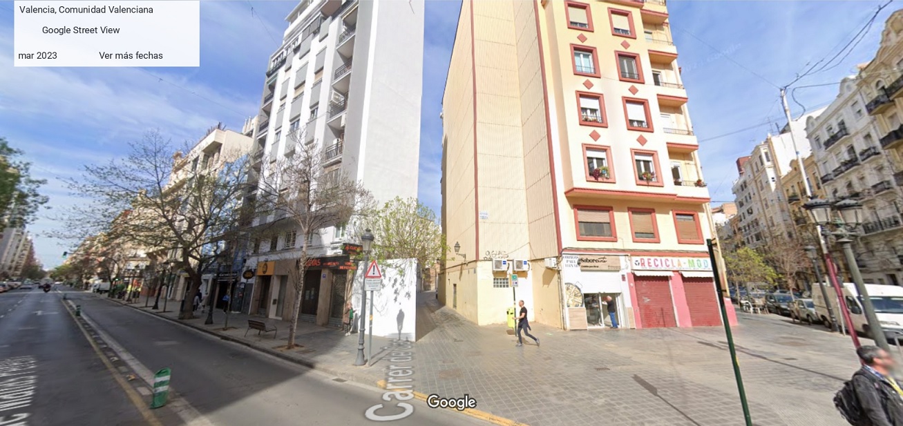
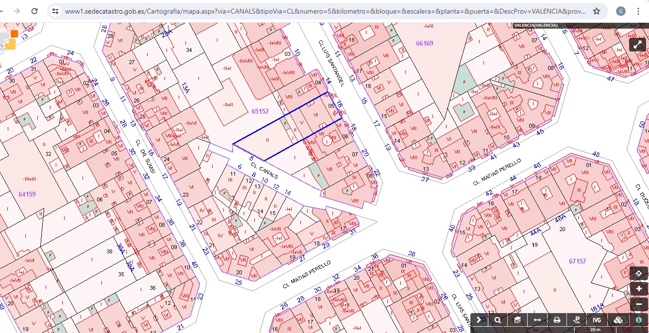
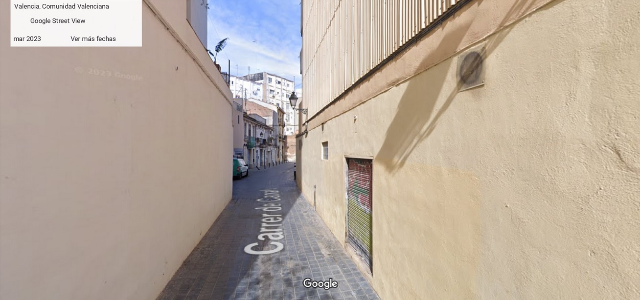
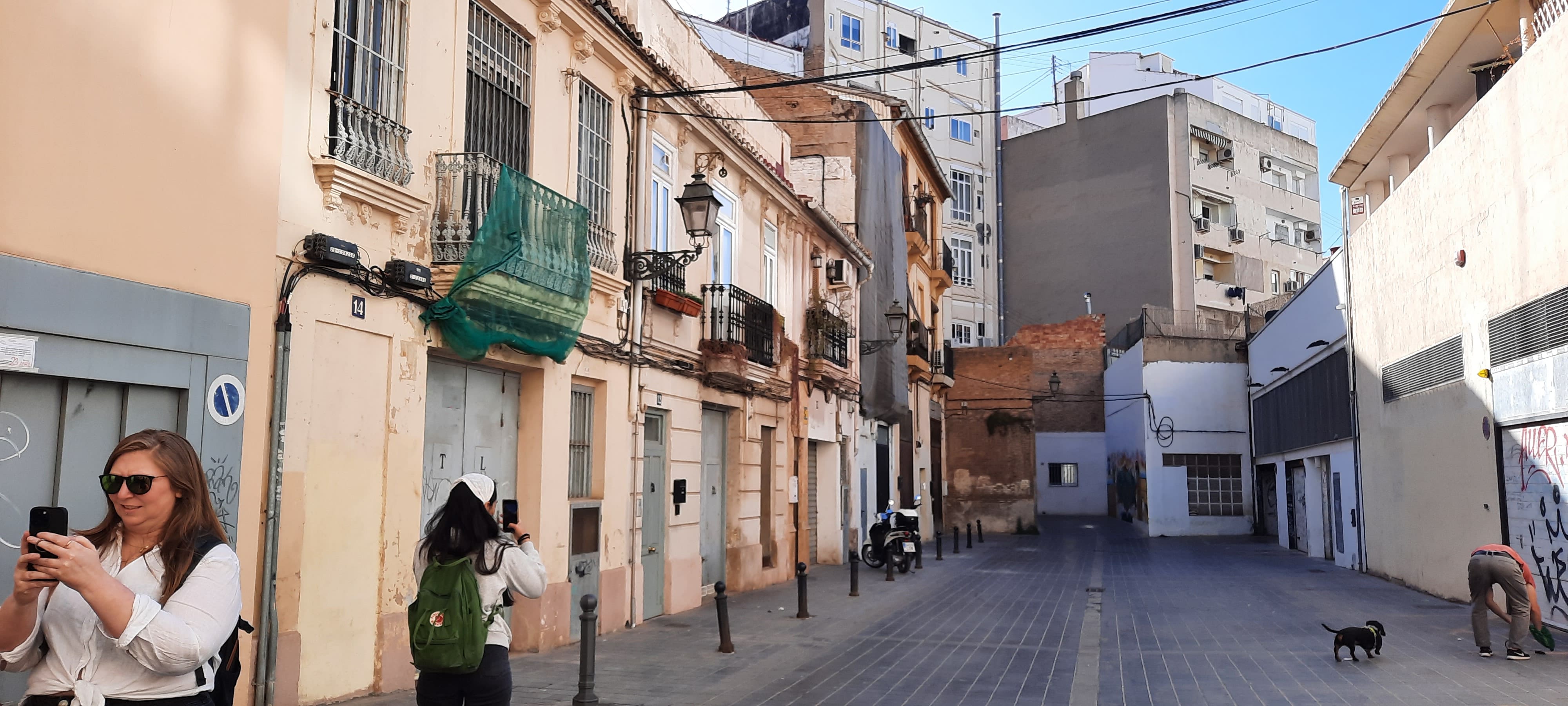
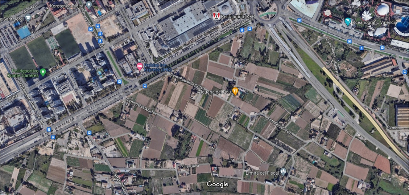
At the intersection of Matías Perelló and Luis Santángel streets we find, in a diagonal position, what looks like the remains of an old orchard path; in fact, it is called Canals Street. As a vestige of the shape of the pre-existing parcel before the urbanization of Ensanche. In the image below you can see what this agricultural plot looked like before the urbanization, because it continues, with the same diagonal shape, beyond Antonio Ferrandis Street, where the orchard emerges.
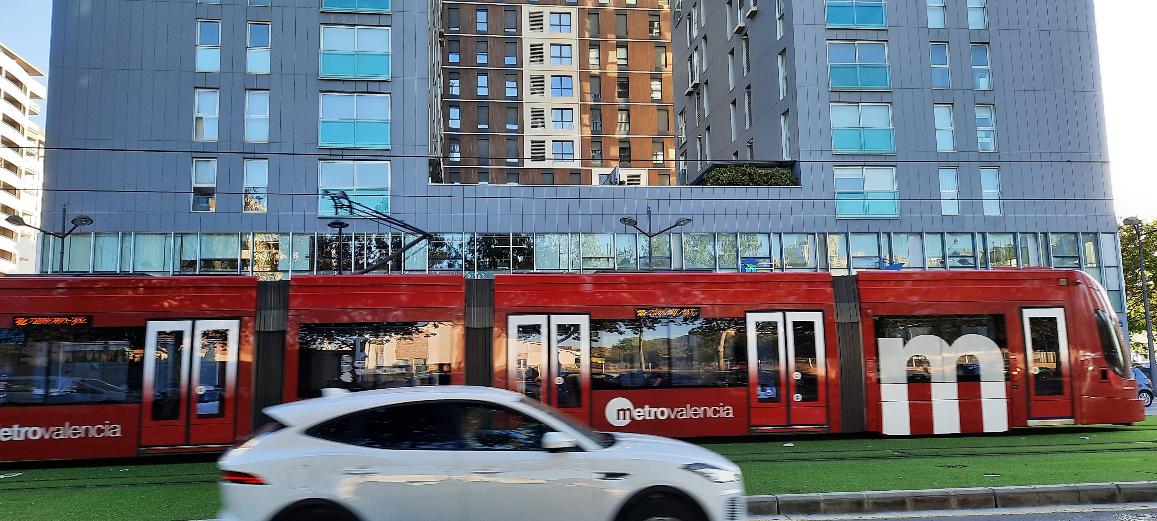
In the last section of our route, the one between Hermanos Maristas Avenue and Antonio Ferrandis Street, the city has definitely changed. One of the participants in the workshop, from New Jersey, commented upon seeing this image: “It’s like we were in Washington D.C.” We are at the place where MetroValència line 10 emerges (which runs the Alacant-Nazaret route). The line that was stopped for years and years (after the Great Crisis of 2008-2012), waiting for the convoy that could not be paid for to arrive. During those years, the tunnel already built filled with water. The most adventurous sailed there.